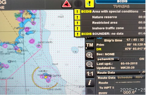
Automatic Identification System
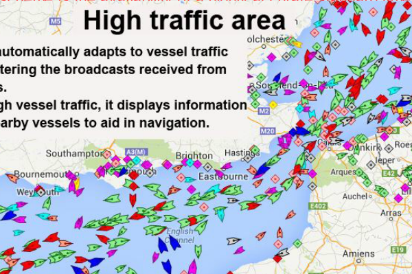
AIS is a system that transmits vessel position, course and speed via a VHF radio channel to all ships within range (typically up to 30 miles). It also receives similar information from other AIS equipped vessels within range. Automatic identification system (AIS) is fitted aboard ships on international voyage with 300 or more gross tonnage…