Browse By

Monthly Archives: June 2021

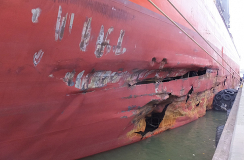
Assessing and Recording Damage To The Ship

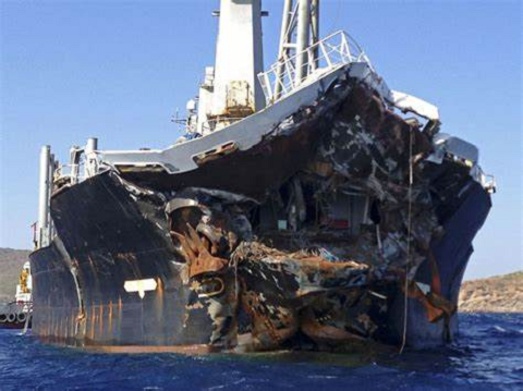
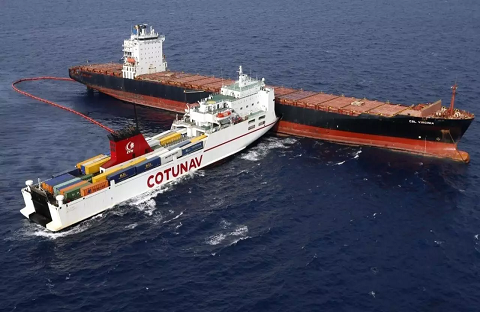
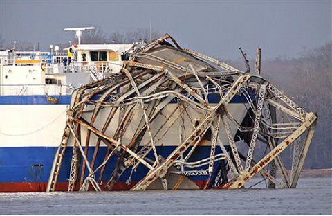
Ships in their operations often suffer damage; the damage could be due to weather, wear and tear or due to accidents. In every such condition it is imperative that the ship’s worthiness to face all the situations is maintained. Such maintenance requires assessment of damage,

Bridge Watchkeeping

Watchkeeping during ocean passages Watchkeeping during ocean passages will require all the activities related to performing a navigational watch as discussed previously. In addition, priority is given to the following Lookout During ocean passages, the principle threat to a vessel is the risk of collision.

Law of Collisions

If the master has forgotten his Rules Of The Road he certainly doesn’t tell the third mate Earliest collision rules, established by custom in accordance with dictates of good seamanship, were enforced by Admiralty Courts in the UK and formed part of their maritime law.

Shipboard Accident Response

Protection and Indemnity (P&I) Clubs insure shipowners and managers for their liabilities to third parties arising out of the operation of ships. The P&I Club does not insure the hull or machinery of a ship, only liabilities. The main elements of P&I cover addressed in

Receiving and Delivering Cargo

Receiving Cargo General Cargo The Owner or his Agent who have booked the cargo must check its condition at the time of carting. Such monitoring shall ensure that: It is suitably packed, Fit for sea-transportation, Not tampered with or damaged, Space allotted for its storage

Investigation and Enquiries – Accidents

Whenever a shipping accident happens and comes under the purview of the M S Act as a shipping casualty, the Master, the Pilot or the person in-charge of the ship at the time of the casualty is required to give notice of this casualty to

ECDIS (Backbone of Bridge)

ELECTRONIC CHARTS There are two types of Electronic Charts available:a) Raster Navigational Charts (RNC).b) Electronic Navigational Charts (ENC). RASTER NAVIGATIONAL CHARTS (RNC) A RNC is a raster chart that conforms to International Hydrographic Organization (IHO) specifications and is produced by digitally scanning a paper chart