After studying this blog, you should be able to:
- State the different categories of navigation in the voyage cycle.
- Pick out the document that can identify, assess, control and monitor risk in each category of navigation.
- List out the risks associated with navigation in pilotage waters.
- Assess traffic density trends and areas in the world known to have heavy traffic density.
- Give examples of areas in the world having perennial heavy weather and list out the measures aimed at mitigating this risk.
This chapter commences the application of Risk Management to a new aspect of shipboard activity, viz., Navigation. Young Apprentices are often drafted into navigational duties subject to circumstantial conditions and approval of the ship’s command. Therefore, the aim of the knowledge content herein is to prepare the Apprentice with the very fundamentals of risk factors that associate with Navigational duties.
Navigation is the science of moving, directing or managing a ship through its course over the water. Navigation at sea categorizes itself, in terms of the risk to which the ship is exposed during the voyage.
The risks are:
- To arrive at and depart from Port.
- Navigation along the coast line that forms Gulfs, Bays, Islands etc.
- Deep Sea Navigation across Oceans and Seas.
The risk composure in navigation is different from the risks studied so far. It is not immediately life threatening, but can be so if a series of serious lapses are allowed to transpire. Navigational risk has a broader band of tolerance when compared to potential risk that associates with deck activities. However, this does not mean that there is more room for negligence in navigational activity than there would be in deck activity. It is very vital to understand that navigational error has higher disaster potential encompassing the environment and third party public assets. In addition, navigational error has potential for total constructive loss to life and property at sea. Given this consequence, it is prudent to approach the Operational Risk Management (ORM) level of navigational risk under time critical processes.
We will focus on the potential risk by evaluating each navigational process the respective category.
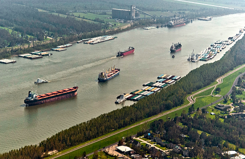
Inland Water Navigation

This category of navigation is rife with multi-faceted risk because of the following factors:
- Restricted room to manoeuvre.
- Restricted availability of under-keel clearance when compared with the maximum draft.
- Traffic density in the water way.
- Restricted visibility.
- Inland Pilotage.
The scope encompassed by this category of navigation includes transit to and from ports located up rivers, estuaries and other enclosed water bodies.
Examples of internationally known inland navigable waterways are the River St. Lawrence Waterways & the Great Lakes, Mississippi River, Hoogly River, Suez and Panama Canal.
The risk management along the structured ORM process takes the following work-flow path:
- Restricted Room to Manoeuvre: Whenever there is restricted room to manoeuvre in inland waterways potential risk evolves from the threat of grounding or collision. The key to managing this risk is to ensure a quick response from the steering gear and the propulsion machinery.
A typical steering gear is powered with two steering motors for optimum response of the tiller to the helm. In restricted waters, both the motors are required to be running. Response time, with both motors running, from hard-over to hard-over (non stop through mid-ships) should be no more than about 28 seconds. Prior to the commencement of an inland water passage, this test must be judiciously carried out through its entire process, including the rudder indicator at its various locations. Even individual steering motors must be put through the test, singly and separately. The conduct of this test must be recorded into the appropriate log book. Deficiencies, if any, must be rectified instantly and feedback recoded. The log book entries in this regard, including deficiencies observed and its subsequent rectification, turn into the controlling document under the ORM process.
As regards propulsion, it is a normal practice to have the engines operated at manoeuvring speeds with the engine room watch monitoring the same to provide quick response to the orders from the bridge.
- Restricted Availability of Under-keel Clearance The potential risk arising from this phenomenon is directly linked to the ship’s draft and trim prior to transiting the waterway. The first and prime requisite is that the ship is upright on an even-keel. Squat is the reduction in under keel clearance resulting from bodily sinkage and change of trim, which occurs when ship moves through water. The algebraic sum of bodily sinkage and the change in trim -forward or aft – is the “ship’s squat”.
- Traffic Density in a Waterway Traffic density referrers to the number of ships navigating in the vicinity at any given time. The density of traffic depends on number of ships their size, speed and courses relative to our own. The potential risk of close quarter situations and possible collision thereafter intensifies on the quality of watch kept and the controlling measures put in force for the vicinity. These controlling measures, though not restricted are the following:
- Traffic separation Schemes (TSS).
- Vessel Traffic Management & Information Systems (VTMIS)
- Coastal pilots which provide navigational information for coastal and inland navigation
Whilst TSS regulates the flow of traffic, VTMIS exchanges information on ship’s navigation in the vicinity based on a reporting system. The system imposes speed Iimits, compulsory pilotage districts and constitution of bridge manning levels and any other measures deemed necessary to protect inland waters within its authority. Coastal pilots provide detail information.
The International Regulations for the prevention of Collision at Sea 1972; COLREGS-72 for short, governs the conduct of ships navigating in the vicinity.
A through knowledge, understanding and application of these regulations is an absolute necessity for every bridge watch-keeping person. A clear understanding in tandem with experience in the timely application of the regulations in all conditions of visibility is the basis of the ORM technique in this segment of potential risk.
Restricted Visibility
This phenomenon is a bridge team’s biggest nightmare and has the potential to create disasters. The visibility is restricted to varying degrees on account of the following climatic conditions:
- Mist, Fog, Haze etc
- Sand Storms.
- Torrential Rain
The risk associated with restricted visibility is that of collision or grounding, both of which can cause loss of human lives (Capsizing), destruction of property (ship & cargo) and environmental pollution (Oil spills).
The key to managing this risk lies in the understanding of bridge procedures early in one’s career at sea. These include learning how to steer, keep look out duties, use of navigational equipment and understand the COLREGS. The COLREGs requires the look-out to be maintained as follows:
Every vessel shall at all times maintain a proper look-out by sight and hearing as well as by all available means appropriate in the prevailing circumstances and conditions to make a full appraisal of the situation and of the risk of collusion.
In restricted visibility a look-out needs to pay attention to sound signals transmitted by ships and fixed navigational aids (such as buoys, lightships etc.) in the vicinity. The interpretation of these sound signals as per the COLREGS-72 are controlling factors in the assessment and thereafter monitoring the risk in accordance with the principles of ORM.
With experience and certification, a look-out can rely upon the radar equipment to safely conclude the movement of ships in restricted visibility. This technological development formed the basis of amending the previous definition of look-out that viewed radars as being merely an aid to the process of assessing the risk of collusion. The ship’s modern day radar fitted with Automatic Radar Plotting Aids (ARPA) plays a central role under the concept of ‘all available means’ appropriate in the prevailing circumstances and conditions.
Pilotage — Harbours and Inland waters
Navigation in enclosed waters under compulsory pilotage poses a risk that largely emanates from human factors, especially in a cross-cultural set-up of a Bridge Management Team. Though the Pilot-Master relationship is one amongst highly qualified and experienced professionals, disastrous accidents have occurred in the past, prominent amongst them being the ‘Exxon Valdez’ (1989) and the ‘Sea Empress’ (1996). Both these ships had pilots on board either just before the accident or at the time of occurrence.
The inter-personnel factors that add to the burden of risk are as follows:
a) Fallacies: The myth that the presence of the pilot on the bridge relieves the bridge team of their duty to be vigilant, and alert to the fast changing circumstances and most importantly the need to be well rested. The Master-Pilot card is the document that responds to the ORM process applicability in dealing with the risk in a proactive manner..
b) Communication Skills: Under pilotage the time tested dictum has always been, “To Master’s Orders & Pilot’s Advise”. In instances when the Master may have left the bridge, the duty-officer stands-in for him. The duty officer and his bridge team are duty bound to carry out their normal functions in the same manner as though the pilot is not on board, namely constantly monitoring the ship’s position and course and maintaining a sharp look out.
c) Adherence to Instructions: Another feature of the officer’s responsibility is to ensure that the pilot’s instructions are strictly adhered to and carried out to his (the Pilot’s) entire satisfaction. However, what happens if the pilot’s actions are cause for concern to the duty officer? The communication of this concern requires urgent action and immediate necessity would be to call for the Master.
d) Coastal Navigation: Coastal Navigation is conducted through shipping lanes that pass off the coast. This makes it possible to identify and correlate shore objects such as lighthouses, prominent landmarks, other navigational aids etc., with the navigational chart in use. Regular plotting of the ship’s position using different navigational equipment. such as Radar, azimuth circle for cross bearings, GPS satellite position fixing systems and the echo sounder to cross check soundings found at the fixed Position, are measures to minimize the risk of going off course and running aground. Ensuring course checks and corrections where necessary, finding average speeds of the ship and the Estimated Arrival Times (ETA) is some of the information that can be derived from these navigational procedures.
The other potential risk that arises during coastal navigation is collisions. Traffic patterns in the intended navigational area should be studied and analyzed for risk assessment as part of passage planning. Some of the areas known to be navigational difficult areas are:
a. The Dover strait of the English Channel is one of the most thickly dense traffic areas. Cross-Channel traffic from UK to France and Belgium adds to the complexity of traffic which not only encounter end on traffic, but also crossing traffic.
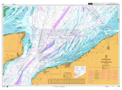
The presence of fog or poor visibility increases the risk of collision exponentially. Several collusions had been reported due to speed in excess of the safe limit as defined in the COLREGS-72 under restricted visibility, or late avoiding action by the stand-on vessel.
b. The Singapore Straits between the Brothers Light house at the Western approach and the Horsborough Light House at the Eastern approach is another such area with heavy traffic densities and complex multi-directional traffic.
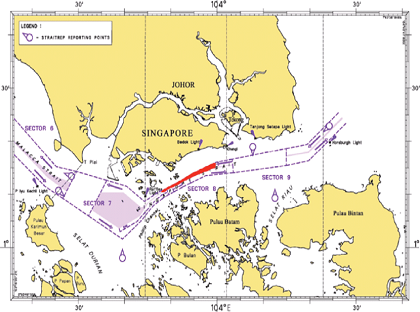
c. Very Large Crude Carriers (VLCC) often transit the straits severely restricted in their ability to manoeuvre due to the available water in relation to the draft. This traffic often confronts ship’s entering or leaving the working anchorages, container terminals or the ship repair yard of the Port of Singapore. These converging zones are marked on the chart as precautionary areas. Precautions must be taken such as, though not restricted to, having the full bridge compliment, engines ready for manoeuvres without any notice and steering gear powered by both motors.
d. The Inland Sea in Japan is another such area known for some of the most complex traffic pattern. The problem is further compounded by difficulties in understanding the work culture and language of the Japanese pilots. The type of traffic one encounters includes fishing vessels and self propelled flat barges that ply between the numerous industrial ports. This cross traffic thickens during night when the barge traffic increases. Fishing vessels abound by lending credence to the long standing observation that in Japanese waters there are ‘more fishing vessels than fish’.
In this manner, certain zones in the world can be marked out on the basis of traffic trends judiciously blended with one’s own experience. At all times the following risk-alleviation measures rate high in priority:
- Always ensure that the latest chart, up to date in all respects is in use.
- All voyage publications are of the latest edition and updated per latest notice to mariners.
- Efficient Look-Outs are posted whenever required.
- Standing and specific instructions from the Master are well understood and strictly complied with, especially the guidelines to call for the Master’s presence on the bridge.
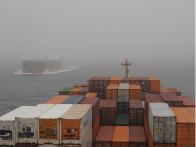
Deep Sea Navigation
Ocean routing defines deep-sea navigation tracks as voyages that transcend land marks across oceans and seas.
Voyages to and from ports on either side of the Atlantic and Pacific oceans, Mediterranean , Arabian and South China Seas, Indian and the Southern oceans requires ships to adopt deep sea navigation.
The potential risk use to arise when obtaining position was difficult due to weather patterns and exposure to the elements without the presence of the ever protective ‘lee’ of the nearby land. However, in this day and age technology has come a long way in managing this risk. Global Positioning Systems (GPS) have revolutionized position fixing methodology. Weather satellites in orbit track low pressure systems that fore-warn ships enabling them to take timely evasive action.
The potential risk of the adverse weather in deep sea navigation lies in the low-pressure systems that deepen into depressions and strengthen into devastating storms that either remain stationary or move with an unpredictable course and speed. Certain areas such as the North Atlantic, Pacific and China seas, the Bay of Biscay, the Cape of Good Hope are areas of heavy and boisterous weather. In deep sea navigation, weather pattern plays an important role in ocean passage planning. The ORM process in identification, assessment, controlling and monitoring the hazards has its controlling documents in the form of weather routing charts on the one hand and the ship stability and trading patterns on the other.
The following ship documents need to be generated to control and monitor risk as the trans-oceanic voyage progresses:
- Weather routing charts and weather reports from weather reporting stations situated in the vicinity.
- Ship’s Stability calculations showing the departure and arrival condition including the worst stability condition.
- Ships cargo plan showing cargo type and risk identification notes such as angle of repose for bulk cargoes and calculated GM curve. For break-bulk deadweight cargoes, such as steel coils and slabs, the securing arrangements are important.
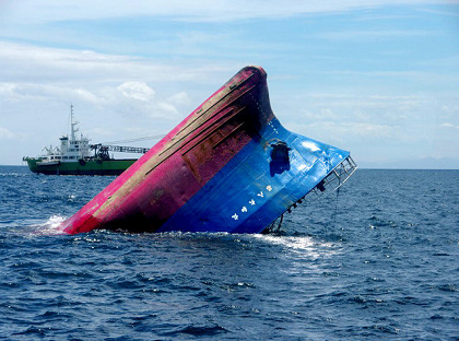
The bulk of mishaps that the potential risk culminates in such deep sea navigation routes are attributed to shifting of heavy deadweight cargoes during heavy weather leading hull to ingress of water from the hull and thereafter to uncontrolled flooding of the space. As bulkheads begin to collapse, the ship ultimately capsizes. Another sequence of events that contribute to disastrous accidents during heavy the ingress of water from the hatch covers as the ship labours through a boisterous seaway taking on seas on the forward hatch covers.
Though the cause is different from the reason pertaining to shifting of cargo the end result is the same and is always a source of concern to the maritime community.
Preventive and proactive steps can be taken to counter the risk of deep sea navigation as outlined above. The following steps are significant:
- Planning the stability of the ship for an ocean passage starts at the loading stage itself and is achieved by:-
- Homogenous distribution of bulk cargoes with very careful consideration to the sea-going stresses likely to build-up. The ship’s Loadicator is an excellent aid towards achieving optimum stress and the stability condition.
- Calculation of optimum stability throughout the voyage by taking into account the consumption or supply of bunkers and / or putting in or discharging ballast allowing for ship’s age. Even though every ship is maintained to bear the same stresses throughout her life, experience has shown that when loading and facing adverse weather the age factor needs to be taken into account.
Metacentric height or the GM of the ship to determine stiff or tender condition.
Knowledge of characteristics tendency of ships relating to stability such as :
- Container ships and car carrier are predominantly tender due to their high windage or freeboard.
- Bulk carriers on the other hand are predominantly stiff due to heavy cargoes loaded lower down in the hold.
The securing of cargoes and the trimming of bulk cargoes are operations that merit close attention during loading operations. To ensure even and trimmed loading, careful attention needs to be given at completion time while trimming chutes can be used to push bulk cargo into the wings.
- Remember that:
- Stiff ships often put heavy pressure on cargo lashings due to the rolling periods being small
- Tender ships on the other and have small righting levers that may keep a ship for several seconds at the extremity of the roll allowing poorly trimmed light bulk cargoes to shift in partly filled compartments.
Appropriate rules cover these conditions and strict compliance is needed.
Ask yourself
“How is this hold going to look when the ship is heeled forty-degrees every now and then for several days on the ensuing voyage?”
The required answer will set the standards in lashing and trimming operations.
3. Ocean passage in foul weather conditions is a risk-infested activity as the unknown elements come to fore. Signing up with a recognised weather routing organisation controls this risk. Shore based weather routing advisories constantly upgrade the status of weather systems including the state of the sea and swell on the ship’s course line and advice the best course to follow. The suggested course gives adverse weather and sea conditions a wide berth. Ship handling in heavy weather requires constant attention to ensure that the ship does not become too vulnerable to beam swell, synchronous rolling and pitching.
| Synchronous Rolling & Pitching When the ships roll period is equal to that of the apparent wave period, each roll is boosted by the wave and a condition of synchronous rolling is set up. An alteration of course rapidly helps to change the apparent wave period. Heavy rolling places high stresses on the transverse structure of the ship. Synchronous pitching occurs when the period of pitch is equal to that of the encounter. The condition causes excessive racing on the engine governor as the propeller emerges from the water. A reduction of engine speed will destroy the condition both the synchronous roll and pitch place enormous amount of stress on the structure of the ship. |
Conclusion.
Managing Navigational Risks is best approached by breaking up the process into voyage cycles namely Inland, Coastal and Deep sea navigation . Each category a different and unique risk profile and as such, a different ORM technique.
Common to all the categories is the importance of having the latest charts and publications for the area covered by the voyage. Compliance with the mandatory requirement of keeping good look-out duties and the well rested and fit watch-keeper within the meaning of the Bridge Procedure Code is equally important.
The conduct of the ship’s navigation under pilotage is best learnt during the cadetship programmes both on deck and in the bridge. This observation and the actual carrying out of duties as instructed adds invaluable experience that would come in good stead during the later period of independent watch keeping.
A through understanding and the application of the COLREGS-72 is a fundamental requirement of a navigator. Understanding traffic directional patterns for the area is very essential in order to take timely action as per the COLREGS-72.
Knowledge of relationship between the ship’s stability condition and the effect of heavy weather is very important to the planning of ocean passages. The best plan implementation is always before the commencement of the voyage.
The securing and trimming operations as the case may be should always be viewed as a risk factor to be controlled. Heavy cargoes breaking loose from its lashing or bulk cargo shifting in rough weather is a real danger to the safety and integrity of the ship. Always remember that once either of these two events begins to occur in rough seas, there is nothing that can be done about the situation steadily deteriorates into a disaster.