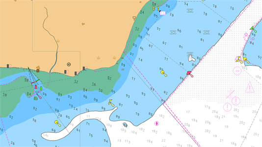
All navigable waters are not yet covered by ENC data and vessel may be required to use ECDIS in Raster Chart Display System (RCDS) mode using ARCS / approved raster charts.
If suitable ENC charts are not available from any source, then the use of raster charts is accepted only in conjunction with updated folio of paper charts
The following alarms and indications are required for an ECDIS operating in RCDS mode:
1. ECDIS operating in raster mode
2. Deviation from route
3. Position system failure
4. Approach to critical point
5. Different geodetic datum
6. Malfunction of RCDS mode
7. Large-scale RNC available for ship’s position
Following precautions shall be taken while using raster charts:
1. At the time of voyage planning, it is important that survey notes are carefully checked.
2. The navigator should not alter WGS84 datum on the GPS to match that of the raster chart as required position transfer is automatically carried out by the ECDIS software.
3. The navigator should be aware that raster charts do not generate automatic warnings of potential hazards. The displayed data is merely a digital copy of the original paper chart, the image has no intelligence and other than visually, cannot be interrogated.