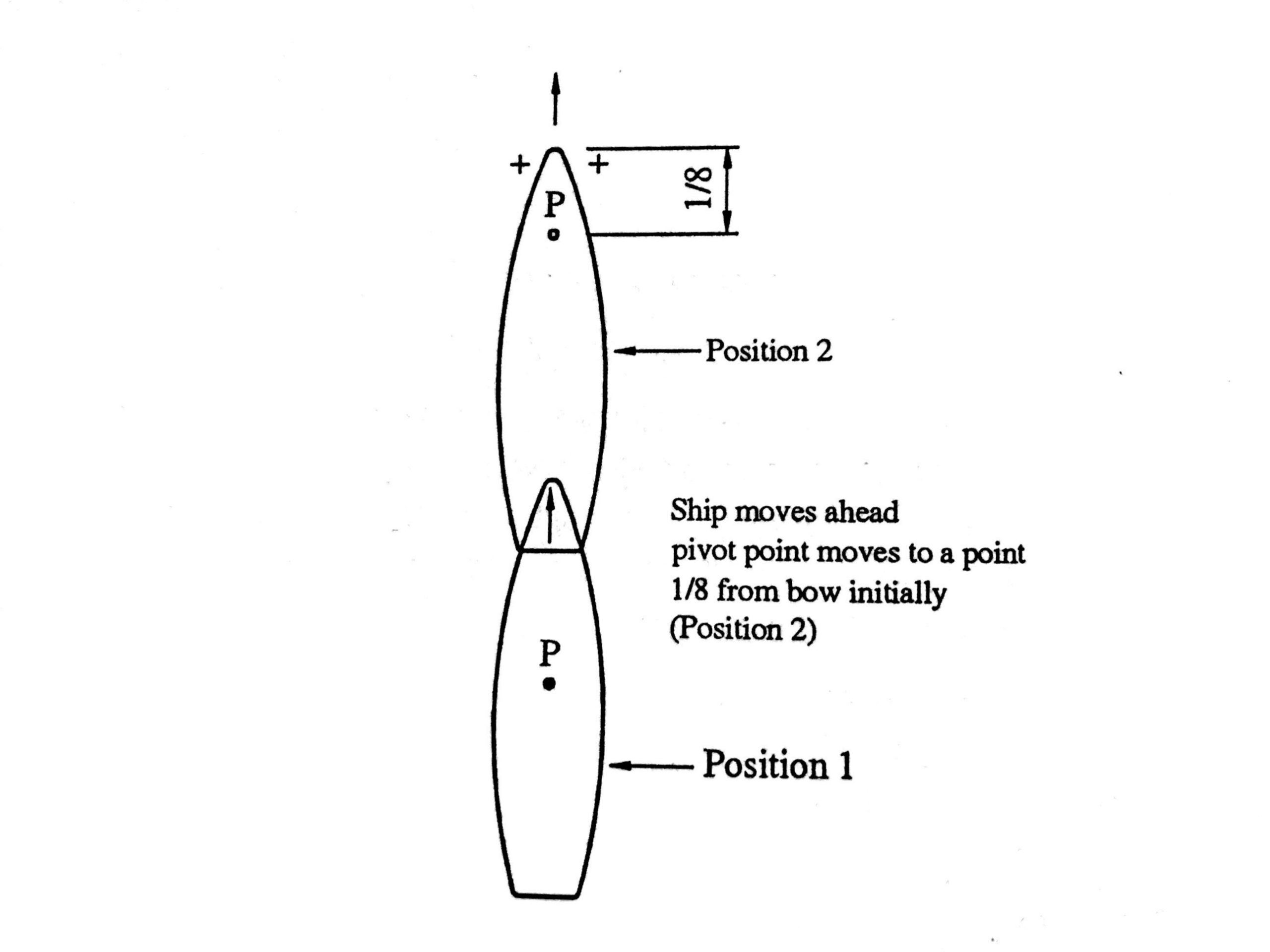
USE OF ECDIS FOR PASSAGE PLANNING
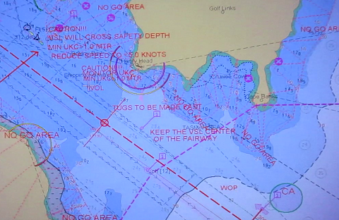
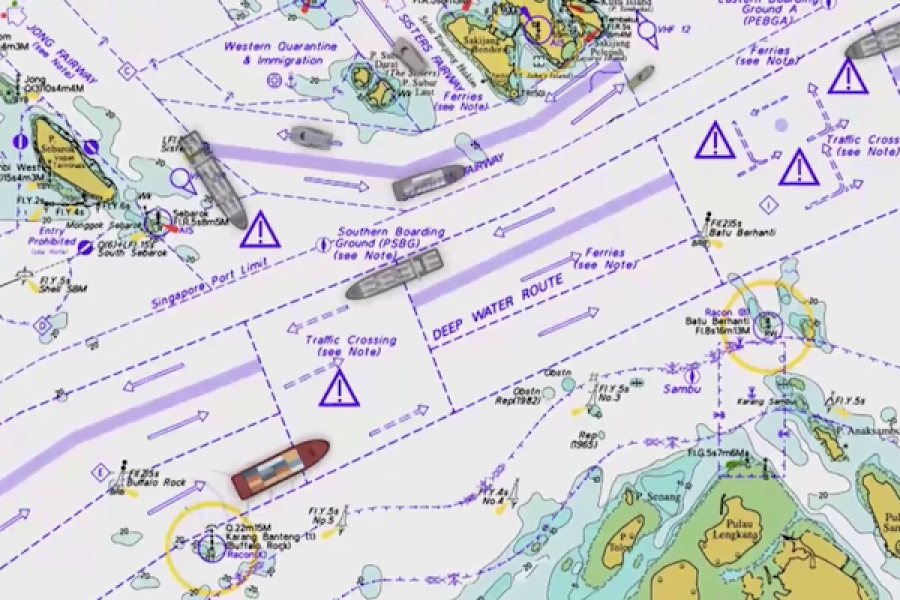
CHECKS PRIOR USING ECDIS FOR APPRAISAL AND PASSAGE PLANNING Following checks should be carried out by the Navigating Officer while carrying out passage planning on ECDIS: Not all sea areas are covered by ENC charts. The electronic chart coverage for the voyage must be adequate and all relevant charts must be fully corrected. For areas…