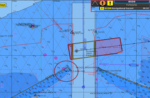
ECDIS (Backbone of Bridge)
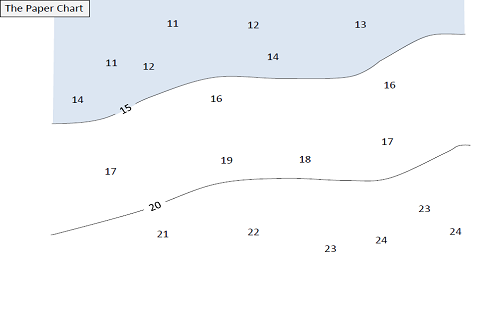
ELECTRONIC CHARTS There are two types of Electronic Charts available:a) Raster Navigational Charts (RNC).b) Electronic Navigational Charts (ENC). RASTER NAVIGATIONAL CHARTS (RNC) A RNC is a raster chart that conforms to International Hydrographic Organization (IHO) specifications and is produced by digitally scanning a paper chart image. The displayed data is merely a digital copy of…