
Objective
To understand classification of clouds, the various types of clouds and the weather associated with each.
Classification
Clouds are classified according to the height of the base above sea level and their appearance.
Low clouds, medium clouds and high clouds.
Clouds can form at any height from sea level up to the tropopause, which is about 8 km above the poles, about 13.5 km above temperate latitudes and about 15 km. above the equator. They are hence grouped according to the heights of their bases above sea level.
Low clouds: Clouds having their base between sea level and 2 km height.
Medium clouds: Clouds whose bases are between 2 km and 6 km height.
High clouds: Clouds whose bases are over 6 km above sea level.
The top of each type of cloud may sometimes extend about one or two km above the base of the next higher type. For example, the top of low clouds may be as high as 3 or 4 km above sea level and the tops of medium clouds, as high as 7 or 8 km above sea level.
Special low clouds: Clouds whose base is at low cloud level but the tops may extend up to the tropopause or a little higher.
Composition
Low clouds consist entirely of water droplets and high clouds, entirely of ice crystals. Medium clouds may consist of water droplets or ice – mainly water.
Classification according to appearance
There are four main types of clouds classified according to their appearance:
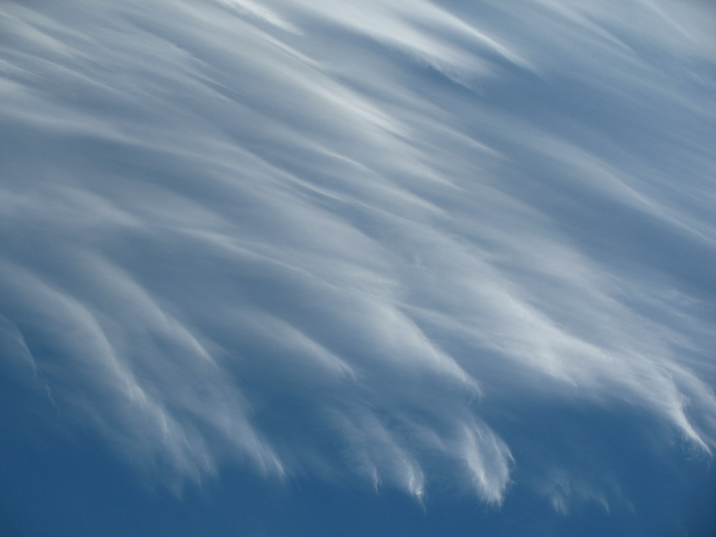
1. Cirrus: A silvery cloud in the form of feathers or fibres seen high up against a blue sky.
2. Cumulus: A white cloud, shaped like a cauliflower, which can have great vertical extent.
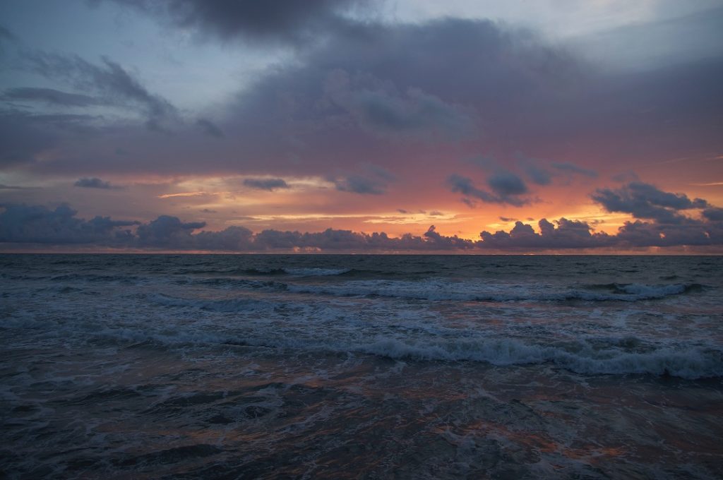
3. Stratus: An even layer of grey cloud, not giving rain.
4. Nimbostratus: An even layer of grey cloud giving rain. Nimbostratus was formerly called Nimbus. Hence it is an original cloud type and not a combination of Nimbus and Stratus.
Various combinations of the above mentioned four types exist and are described separately later.
Names of clouds have abbreviations that consist of two alphabets – a capital one followed by a small one — as indicated below:
| HIGH CLOUDS | MEDIUM CLOUDS | LOW CLOUDS | SPECIAL CLOUDS |
|---|---|---|---|
| Bases between 6km and the tropopause. | Bases between 2 and 6 kn above sea level | Bases between sea level and 2 km above sea level | Bases at low cloud level but tops may go upto troppause. |
| Cirrus (Ci) | Altostratus (As) | Stratus (St) | Cumulus (Cu) |
| Cirrostratus (Cs) | Altocumulus (Ac) | Stratocumulus (Sc) | Cumulonimbus (Cb) |
| Cirrocumulus (Cc) | Nimbostratus (Ns) |
Given below is a brief description of the ten cloud types listed above. One important point to remember is that stratiform clouds indicate a stable atmosphere whereas cumuliform clouds indicate an unstable atmosphere.
Description
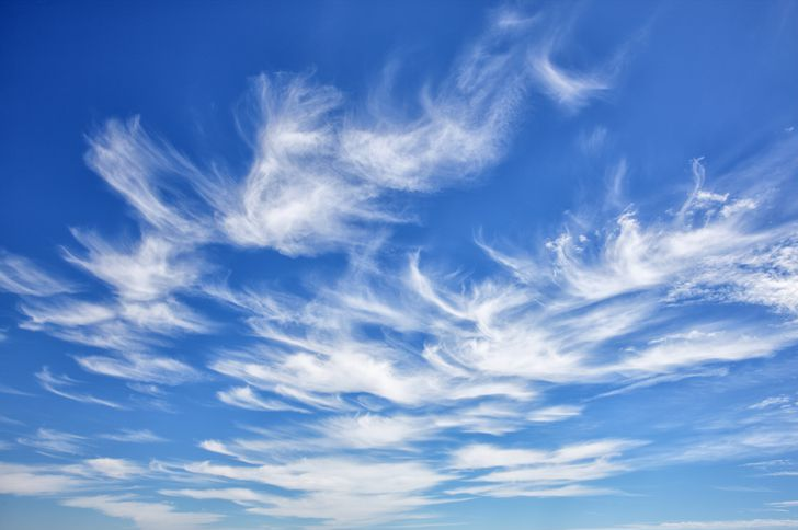
Cirrus:-
Silvery high clouds, appearing like feathers or fibres. Being so high up, they always have a background of blue sky and, during twilight, often appear bright red or yellow. On dark nights, Cirrus can be detected only by its dimming effect on stars.
Cirrostratus
A thin whitish veil of high cloud through which the sun or moon has a watery look. The outline of the sun or moon is sufficiently clear for altitude observations by a sextant. Haloes are often seen due to Cirrostratus clouds. Cirrostratus clouds should not be mistaken for Altostratus clouds, which are described below.
Cirrocumulus
A high layer of cloud in the form of small flakes or cauliflower, white in colour with no dark shadows in between.
Altostratus
A thin greyish or bluish veil of cloud through which the sun or moon appears very dim — as if seen through frosted glass. The outline of the sun and moon are hazy and not clear enough for altitude observation by a sextant. Altostratus does not give rise to haloes. Darker patches of shadows may be seen due to variation in the thickness of the veil.
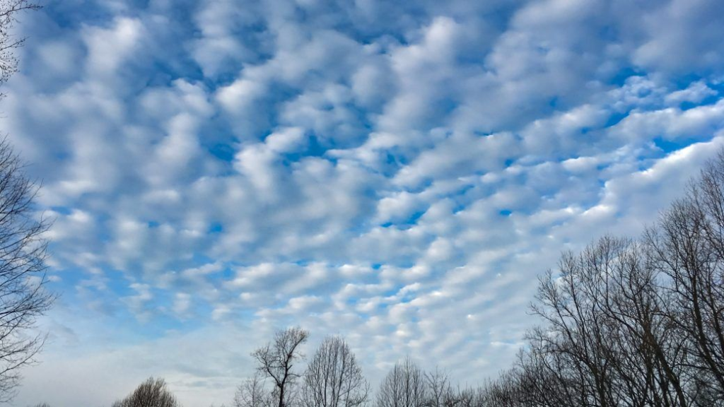
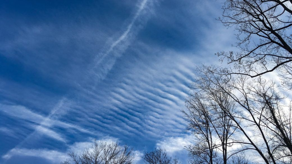
Altocumulus
Clouds in patch layer or sheet form, white or grey or both in colour.
Has dark shadows in between and has the appearance of small-flattened globules or rolls or long bands or almonds, all of which may be in regular patterns aligned in one or sometimes two directions.
Stratus
A low, even layer of dark grey cloud, with light and dark patches. It has a dry look and does not cause precipitation. It resembles fog, but is not experienced at sea level. It can obscure the sun completely and can greatly weaken daylight. It should not be confused with Nimbostratus. Small patches of Stratus, spread out, are referred to as Fracto-stratus.
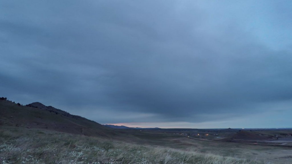
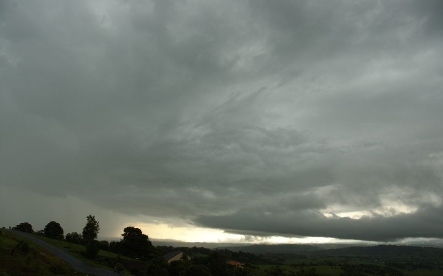
Nimbostratus
Low dark, even layers of grey cloud generally uniform and threatening in appearance with no light coloured patches. It has a wet look. if precipitation takes place, it is continuous, not intermittent. Nimbostratus is usually formed by gradual thickening and lowering of a layer of Altostratus. It can completely obscure the sun and greatly weaken daylight.
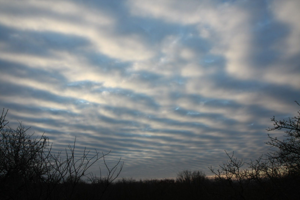
Stratocumulus
Is a cloud by itself and not a combination of stratus and cumulus. These clouds consist of a layer or patches of globular masses, which appear soft. They are grey in colour with dark shadows. The patches generally align themselves in regular patterns in one or two directions. The patches often join together and form an overcast sky, but are distinguishable from Stratus by its wavy or linear appearance.
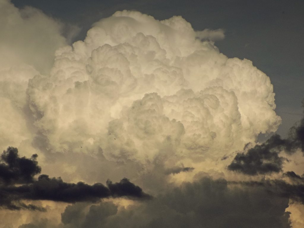
Cumulus
Brilliant, white, thick clouds with flat bases and rounded cauliflower-like tops. Dark shadows are usually seen in them. The outline of each such cloud is very clear-cut. Cumulus clouds may be in patches with ragged edges and little vertical extent called fair-weather cumulus or fracto-cumulus, or they may have very great vertical extent -called towering cumulus. Precipitation, if any, caused by even, well developed cumulus, is usually light.
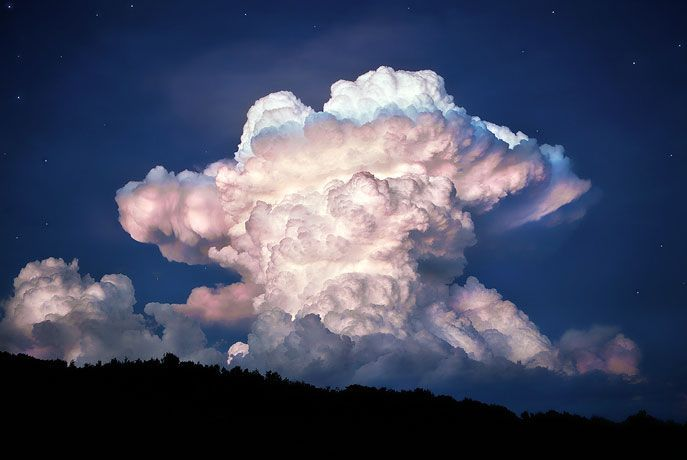
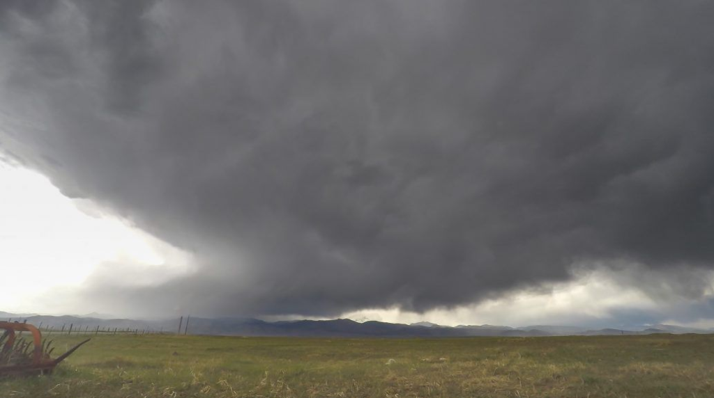
Cumulonimbus
Mass of heavy, grey cloud with its base at low cloud level, having great vertical extent and its top well in high cloud level. It has a threatening appearance and is called a thundercloud. The top of a well developed Cumulonimbus cloud will have, attached to it, a cap of white Cirrus cloud in the shape of an anvil. It is then called anvil-shaped Cumulonimbus. Its base resembles Nimbostratus.
If Cumulonimbus covers the sky completely, its top cannot be seen and hence it cannot be visually distinguished from Nimbostratus. However, if precipitation is experienced, they can be distinguished Cb gives showers (intermittent precipitation with frequently changing intensity) whereas Ns gives continuous precipitation with little variation in intensity.
Cloud formation
To understand the process by which clouds are generally formed and hence their relationship with the weather.
We saw in the previous paragraphs that the clouds can be distinguished by their visual observation and that the clouds are a reflection of the stability of the atmosphere. Stability does not mean stormy weather or otherwise. It is the ability for the continuance of the pattern of weather.
Clouds are formed in four main ways
a) Turbulence: Strong winds blowing over uneven ground strike against the various obstructions and the air gets deflected upwards. This causes a thorough mixing of the air and as the air rises, it cools adiabatically and if cooled below its dew point, clouds will form. These clouds will be of an even layer type (stratus) and their bases will generally be not more than 600m high. Turbulence clouds will be formed in great quantities if the air is maritime (moisture laden) and blows Over cold uneven ground. Over sea, wind speeds of more than 13 knots only (force 4 and over) can produce sea waves of sufficient height to create turbulence clouds
b) Orographic lifting: When a warm, moist wind blows against a mountain range, it begins to climb up the mountainside. During this ascent, it cools adiabatically and after cooling below its dew point orographic clouds are formed. These are of the stratus type. If the mountain is quite high, further ascent results in nimbostratus and continuous precipitation. On the windward side of the mountain peak, clouds are forming steadily whereas on the leeward side, the clouds are dissipating at the same rate (while descending, the air warms up adiabatically and the clouds evaporate). It therefore appears as if a stratiform cloud is stationary over the mountain peak. This is called a “Banner Cloud” e.g., the Cap of Gibraltar, the Tablecloth of Table Mountain of South Africa, the Banner of the Matterhorn, etc. In Greek the word ‘Oros’ means mountain.
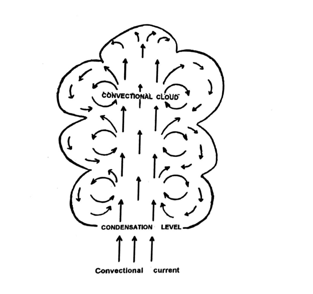
c) Convection: When a parcel of air gets heated, due to any local cause, it expands, becomes less dense than surrounding air, and rises. This is called convection current. This local heating can be caused by contact with warm sea or ground. So long as the parcel is warmer than the surrounding air at each level, it will continue to rise (unstable condition of air).
During this ascent, the rising air cools adiabatically, and when cooled below its dew point, condensation takes place, resulting in convection clouds, which are always of the cumulus type. That is why a large island (more than about 10 miles long) in mid ocean may be seen to have a cumulus cloud above it during daytime, which appears to be stationary. Actually the cloud is continuously forming from below and dissipating to leeward. It is for the same reason that during daytime the coastline of a large landmass may have a long line of cumulus cloud above it, parallel to the coast, though there may be no other clouds to windward. The greater the ascent of air, the greater the vertical extent of the cloud – as the air ascends more and more, it gets progressively cooled further and the excess moisture gets condensed into more and more cloud, resulting in great vertical extent of the cloud – towering cumulus.

If the ascent is very rapid, cumulonimbus cloud may form with its head well into high cloud level, until it reaches the tropopause, beyond which convection current cannot rise. The top of the cloud then spreads sideways, resembling an anvil. This is called anvil shaped cumulonimbus. Actually the anvil consists of ice crystals and is a cirrus cloud.
Over land, cumulus clouds generally begin to form in the morning after sunrise, reach their maximum quantity around late afternoon, when the land temperature is at its highest, and begin to dissipate after sunset as the land cools. Over sea, there is little change of air temperature during day and night and hence cloud development is very little. However clouds may develop over sea at night due to cooling caused by radiation of heat into space, by the upper layers of air. Cloud development over sea therefore, is opposite in time to that over land – over land it forms during day and dissipates at night whereas over sea, the Opposite happens.
d) Frontal lifting: Where a warm air mass and a cold air mass are in contact, their line of separation, at sea level, is called a front. The boundary between them is not vertical. It is inclined towards the colder air mass because the cold air, being denser, acts like a wedge and lifts up the warm air.
In the case of a warm front, the slope is gradual and the up-sliding warm air forms stratiform clouds – nimbostratus, altostratus, cirrostratus and finally cirrus.
In the case of a cold front, the slope is very steep and the up-sliding warm air forms cumulonimbus and cumulus clouds.