Weather routeing is the procedure of ensuring that the ship makes an ocean passage in the least possible time conducive to the safety of the vessel.
In order to do effective weather routeing the following steps must be considered
⦁ Ships performance curves must be drawn
⦁ Understand a wave chart
⦁ Draw the shortest possible track
⦁ Obtain the least time track
⦁ Ensure the track is feasible (after considering navigational and safety factors)
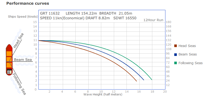
Performance curves are drawn for three sea conditions
⦁ Waves on head sea
⦁ Waves on beam sea
⦁ Waves on following sea
Data for vessel speed in different wave conditions must be extracted from the ships log book or from a sister ship to plot these curves. If there is insufficient data- the curves are interpolated with available data.
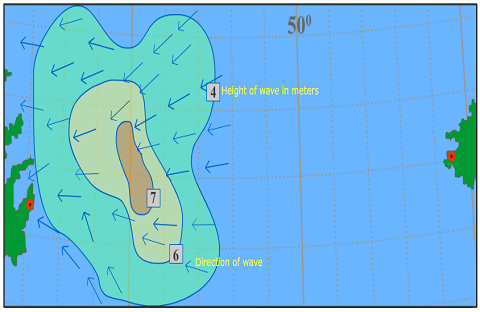
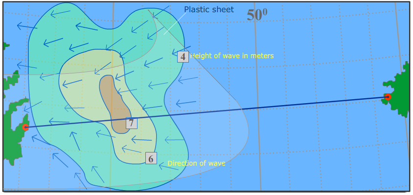
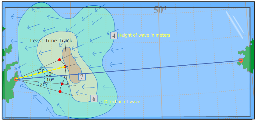
Wave chart
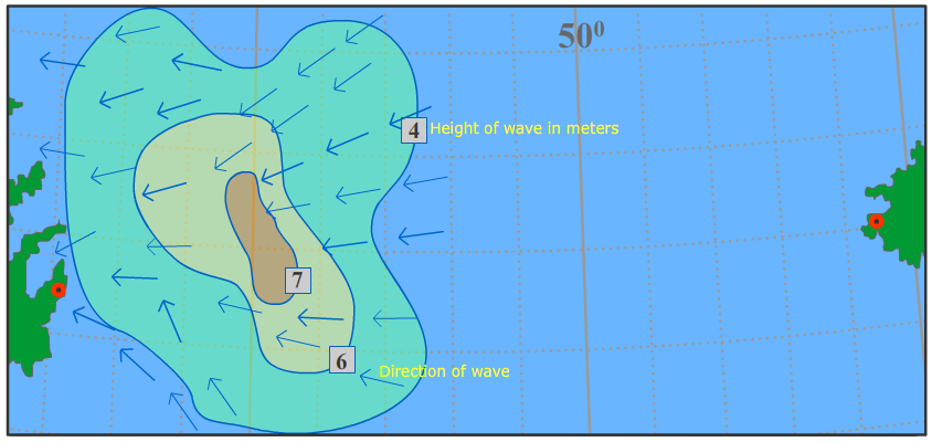
A wave chart is illustrated in the diagram above.
The height of the wave at a given location is shown as the blue curved line
The direction of the waves are shown as blue arrows
Steps to obtain the least time track
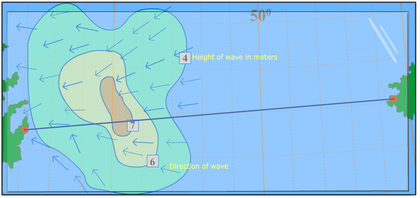
Step 1 : Draw a straight line from start of destination to end of destination. This is the shortest distance to travel.
Step 2 : Place a plastic sheet along the course on the wave chart in order to obtain the time front.
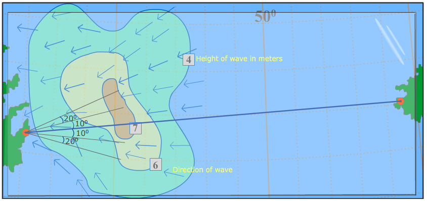
Step 3 : Draw 10° or 20° radial lines on both sides of the vessel course. A total of say 5 lines.
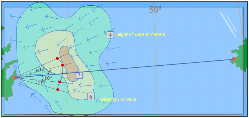
Step 4 : Identify position the ship would be at after 12 hrs on watch of these courses based on wave direction, wave height and the ships performance curves. For eg: on the second radial line to the right of the shortest track the ship will travel 120 nautical miles as the waves are abeam and have a height of 6 meters.
Mark ( ) these points for each of these courses and draw the time front.
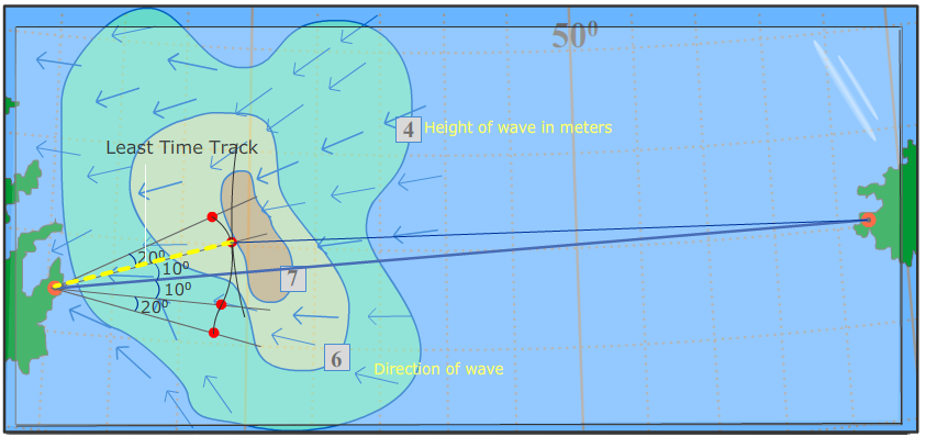
Step 5 : The first radial line to the left of the shortest track is the least time track as it is the point of tangency. The vessel would then follow this track provided it is feasible. Feasibility factors for navigation are – currents, ice, fog, loadline zones and navigational safety (hazards)
Step 6 : Draw the shortest track from the least time track obtained to the destination.
Step 7 : Draw 10° and 20° lines on both sides along the new course of the ship, same as step 3
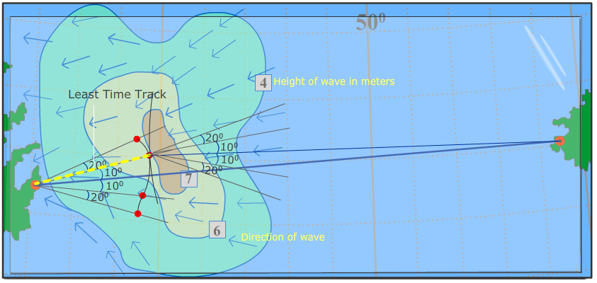
Step 8 : Identify new positions the ship would be at after 12 hrs on these courses based on the wave direction, wave height and the performance curve. Same as step 4
Mark ( ) these points for each of these course and draw the next time front. Repeat the steps to obtain the least time track for 12 or 24 hourly runs till destination.