Digital Selective Calling
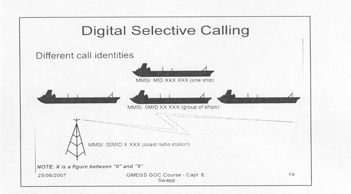
Digital Selective Calling (DSC) Background DSC DSC system is used for calling:– A particular ship– A particular coast station– A group of ships– All ships The system can be used from:– Ship to shore– Shore to ship– Ship to ship Ships must be fitted with a mandatory DSC equipment applicable to the sea area in…