The created route must be checked for potential dangers in case any have been overlooked during route creation. The system will conduct a check for charted dangers, unsafe depths and potential hazards only within the confines of the specified XTL.

The check should consider all scales of ENCs on which the XTL is located. The route check will detect the following danger to navigation parameters within the XTL.
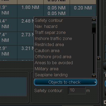
- If the route crosses own ship’s safety contour
- Point objects
- A fixed or floating aid to navigation
- Isolated danger
- Boundaries of a prohibited or geographic area or a geographic area for which special conditions exist.
- Traffic separation scheme
- Inshore traffic zone
- Restricted area
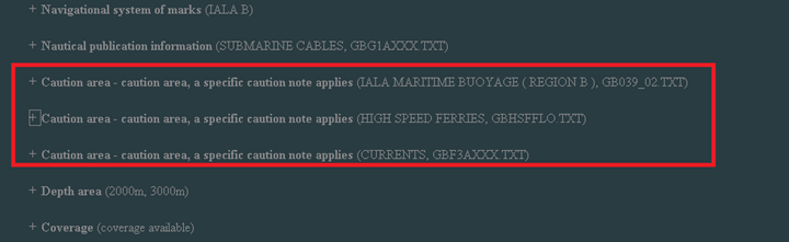
- Caution area
- Offshore production area
- Areas to be avoided
- User defined areas to be avoided
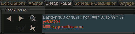
- Military practice area
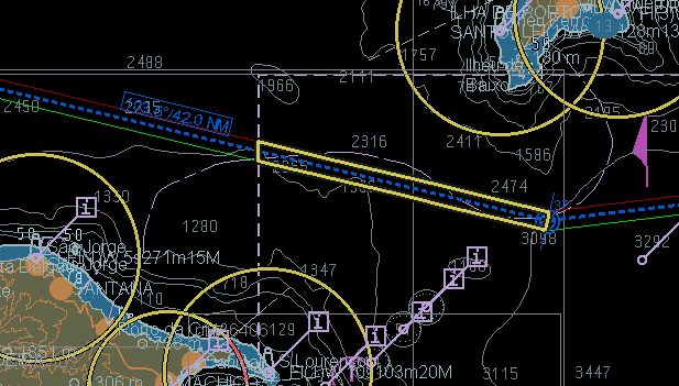
- Seaplane landing area
- Submarine transit lane
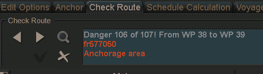
- Anchorage area
- Marine farm/aquaculture
- PSSA (particularly sensitive sea area)
The capabilities of ECDIS with regard to the route check vary considerably. However, most ECDIS will exceed the requirement by also checking for abnormalities in the construction of the route, such as two waypoints in a single location.
Additionally, some ECDIS facilitate a check of ship specific data such as draught and UKC against charted depths within the XTL and turning data to ensure that planned turns are achievable.
Configure
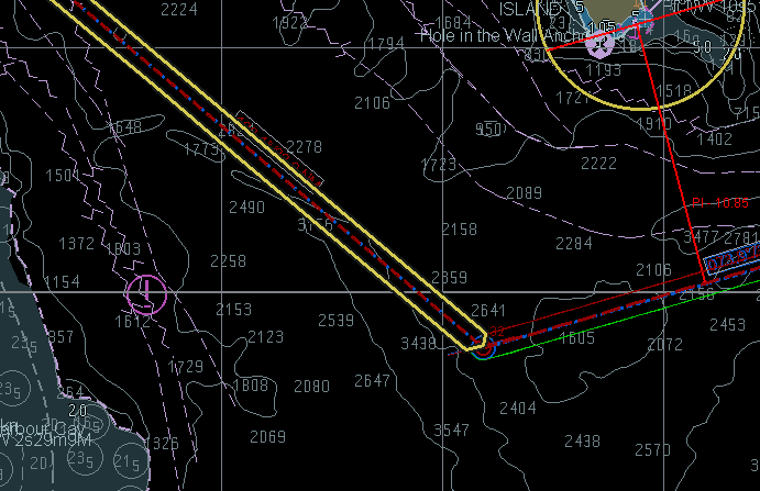
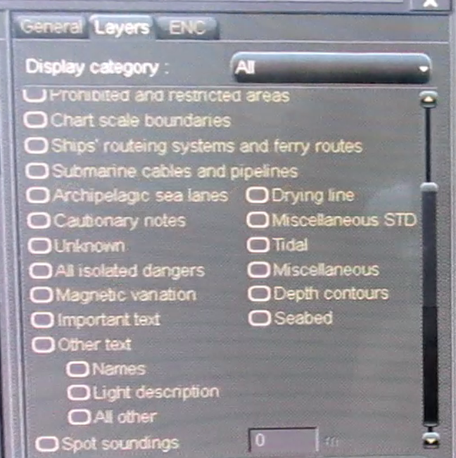
The display mode ‘all other’ should be selected. It is important that all available layers are turned on so that detected dangers are displayed. Not all systems will automatically set the correct criteria to display detected dangers during the check.
Automatic Check
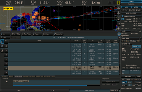
Load the created route and activate the route check function. The system will now check, within the stipulated XTL of the entire route, for dangers on all installed ENCs that cover the geographical area, This may take a while if the route is long as a large quantity of charts will need to be checked..

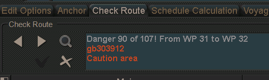
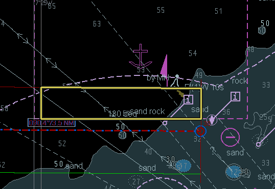
When the check is complete all potential dangers will be listed. Normally the dangers will be listed according to the relevant leg affected, It should be possible to view an individual danger, which in turn will be highlighted by the system so it can be differentiated from other dangers. It may be necessary to perform a cursor pick on highlighted dangers to ascertain further information.
Some detected dangers can be disregarded while others will require revision of the route, which is normally facilitated within the route check function itself. When editing is complete the system should automatically check the modification. The automatic check is complete when all dangers have been analyzed and either disregarded or the route amended and re-checked. A route check should also be performed prior to executing a route on the following occasions:
- After modification of a route
- After a chart update
Anomalies
The nature and quality if parameters that the automatic check seeks to detect means that even the shortest of routes may result in large quantities of detected dangers. If the check does not list any detected dangers the something is wrong. The most likely cause is that no value has been set for XTL, but it may also be that the check has failed to scrutinize all chart scales available. If this happens set the XTL to an appropriate value and where available, set the scale of charts to be checked to cover “all scales” and run the check again.