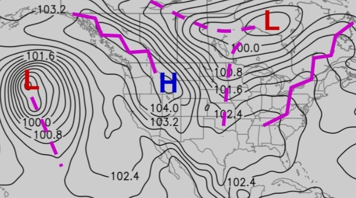
Pressure patterns:
Common for July and January
Permanent High in North and South Atlantic (35˚N/S)
Permanent High in the Indian ocean SE of Mozambique (35˚S)
Permanent high in North and south pacific (35˚N) and 35˚S off Chilean coast.
Permanent Low SW of Iceland close to the east coast of green land.
July (Northern summer / Southern winter)
Atlantic:
There usual permanent Low SW of the Iceland and North Atlantic high and South Atlantic high.
Indian Ocean:
This being the northern summer the land mass is highly heated up resulting in the formation of a huge low over the
northern India off Karachi (Cause of the SW monsoon).
This being the southern winter the Australian land mass is cooled and there is a high pressure formed over the
central Australia.
Pacific Ocean
The usual Permanent high in the north and South Pacific Ocean.
This being the northern summer there is a low over the west American coast off the Californian coast.
January (Northern Winter / Southern Summer)
Atlantic
There usual permanent Low SW of the Iceland and North Atlantic high and South Atlantic high.
Being the Southern summer there is a Low developed over the central South America.
Being the northern winter there is a High over the central Green land.
Indian Ocean:
This being the northern winter the land mass is highly cooled and this results in a high over Asian continent off
45˚N / 100˚ E.
This being the southern summer the African continent and the Australian land mass is heated up and results in the
formation of a Low over the central Africa just above the equator and over the NW of Australia.
The above 3 together drive the NE monsoon during the northern winter.
Pacific Ocean
The usual Permanent high in the north and South Pacific Ocean.
This being the northern winter there is a high over the West American coast off California.
There is also a deep low just south of the Aleutian Islands.
